القاهرة - شيراتون المطار - النزهة - رقم بريدى 4471347

 info@geopatra.org

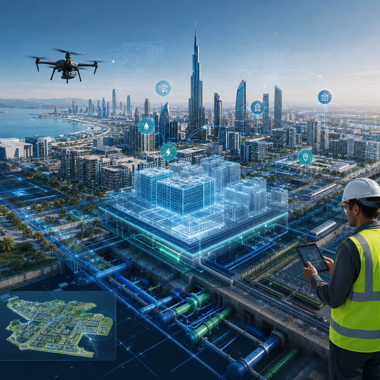
How Digital Twins, GIS, and BIM Are Transforming Smart Infrastructure in the MENA Region  13 July 2026
Cities across the Middle East and North Africa are experiencing rapid urban expansion, large-scale infrastructure development, and growing demand for more efficient public services.As buildings, roads, utility networks, and municipal assets continue to expand, traditional asset-management methods are becoming increasingly difficult to maintain.This has made digital twins, Geographic Information Systems, and Building Information Modeling essential technologies for governments, municipalities, infrastructure operators, and engineering organizations.By combining geographic intelligence, engineering information, and interactive 3D models, Geopatra helps organizations improve urban planning, infrastructure asset management, operations, and long-term decision-making.What Is a Digital Twin for Infrastructure?A digital twin is a virtual representation of a physical asset, facility, utility network, district, or city.Unlike a standalone 3D model, a digital twin can be connected to geographic, engineering, operational, and maintenance data associated with its real-world counterpart.This allows engineers, planners, and operations teams to examine asset conditions, monitor performance, understand relationships, and test possible scenarios in a digital environment.Digital twins can be developed for individual buildings, industrial facilities, transportation systems, utility networks, urban districts, or entire municipalities.The Role of GIS in Smart-City DevelopmentGeographic Information Systems provide the spatial foundation required to understand where infrastructure assets are located and how they relate to one another.Through interactive GIS maps, organizations can display roads, land parcels, buildings, water networks, electrical systems, public facilities, and service areas within one centralized platform.GIS supports municipalities and infrastructure operators by helping them:Locate and document assets accurately.Analyze the distribution of services and facilities.Identify underserved areas and infrastructure gaps.Select suitable locations for future projects.Coordinate field maintenance and emergency teams.Monitor urban expansion and land-use changes.Make location-based decisions.When GIS is connected to a digital twin, the map becomes more than a visualization tool. It becomes an operational environment for understanding and managing the city.How BIM Adds Engineering IntelligenceBuilding Information Modeling focuses on the detailed engineering information associated with buildings and constructed assets.A BIM model may contain information about structural components, dimensions, materials, mechanical systems, electrical systems, construction phases, and maintenance requirements.Integrating BIM with GIS connects detailed building information to the wider geographic environment.For example, a municipality can examine the internal engineering systems of a public facility while also analyzing its relationship with roads, water networks, electrical infrastructure, and surrounding communities.This integration creates a more comprehensive model that can support the entire project lifecycle, from planning and design to construction, operation, and maintenance.Benefits of Digital Twin, GIS, and BIM IntegrationCombining digital twins with GIS and BIM provides several important benefits for municipalities, infrastructure operators, and asset owners.A Unified View of Infrastructure AssetsInstead of storing information across separate drawings, spreadsheets, databases, and applications, organizations can connect each asset to its location, engineering model, maintenance history, and operational data.Better Urban PlanningPlanners can examine development projects and future expansions within a digital representation of the real environment.This makes it easier to compare alternatives, identify potential conflicts, and evaluate project impact before construction begins.Reduced Operating and Maintenance CostsFast access to asset information, maintenance records, and condition data can help organizations allocate resources more effectively and reduce unplanned downtime.Data-Driven Decision-MakingInteractive dashboards, geospatial analysis, and digital models provide decision-makers with clearer information than fragmented or outdated reports.Stronger CollaborationPlanning, engineering, operations, maintenance, and asset-management teams can work from a shared source of information, reducing duplication and improving coordination.Improved Project Lifecycle ManagementThe same digital information can support design, construction, handover, operation, and maintenance, reducing the need to recreate data at each stage.Digital Twins for Utility Network ManagementWater, electricity, sewage, telecommunications, and district-cooling networks are among the most important applications of digital twins for smart infrastructure.A digital utility model can represent pipelines, cables, substations, valves, service points, and network connections while linking each element to operational and maintenance information.Infrastructure operators can use these models to:Locate faults more quickly.Evaluate the impact of network interruptions.Plan preventive maintenance activities.Analyze network capacity.Design future expansions.Improve emergency response.Reduce resource losses and operating inefficiencies.Digital twins can also be connected to sensors and Internet of Things systems, allowing organizations to monitor asset performance using continuously updated information.3D City Modeling for MunicipalitiesThree-dimensional city models provide a clearer understanding of the urban environment than traditional two-dimensional maps.A municipal 3D model can represent buildings, roads, bridges, green spaces, utility assets, and public facilities within a realistic and interactive environment.Municipalities can use these models to study building heights, visibility, shadows, urban density, transportation movement, infrastructure locations, and the potential impact of proposed developments.Each object within the model can also be connected to relevant data, turning the 3D city model from a visual presentation into a practical municipal-management platform.Spatial Analysis for Better DecisionsSpatial analysis is a central component of smart-infrastructure solutions.By analyzing location, distance, distribution, density, accessibility, and movement patterns, organizations can discover relationships that may not be visible in conventional spreadsheets or reports.Spatial analysis can help identify the best location for a new public facility, measure service coverage, map high-risk areas, or assess how a new project may affect surrounding infrastructure.Smart maps and interactive dashboards make these findings easier for technical teams and decision-makers to understand and apply.Why Accurate Field Data MattersThe quality of a GIS platform, BIM environment, or digital twin depends on the accuracy of its underlying data.Field surveying and data collection are therefore essential stages of infrastructure digital-transformation projects.These activities may include locating physical assets, documenting their conditions, collecting engineering information, conducting aerial or terrestrial surveys, reviewing existing records, and standardizing data.Accurate field data ensures that the digital environment reflects real-world conditions and reduces the risk of errors affecting planning, construction, maintenance, or operations.How Geopatra Supports Infrastructure Digital TransformationGeopatra delivers integrated engineering and digital solutions that combine field expertise with modern geospatial and building-information technologies.The company’s capabilities include:Digital-twin development.GIS and BIM integration.Municipal and infrastructure 3D modeling.Water, electricity, and communication network management.Field surveying and data collection.Smart-map development.Advanced spatial analysis.Interactive dashboards and digital platforms.Infrastructure asset and project lifecycle management.Each project begins with an assessment of the organization’s objectives, assets, datasets, and operating requirements.Geopatra can then collect and organize the required data, develop the appropriate digital models, and integrate them with existing operational systems.The Future of Smart Infrastructure in MENAAs investment in new cities, urban developments, transportation systems, and utility networks continues across the MENA region, demand for integrated infrastructure data will continue to grow.Organizations with accurate asset records and connected digital platforms will be better positioned to plan expansion, optimize resources, reduce operating costs, and respond to change.Infrastructure digital transformation is no longer limited to converting paper maps and drawings into electronic files.It is now a comprehensive process that connects geographic data, engineering models, asset records, operational systems, and advanced analysis within a unified environment.Smarter Infrastructure Starts with Better DataDigital twins, GIS, and BIM transform complex spatial and engineering information into practical tools for planning, operations, and infrastructure asset management.By combining accurate digital models with spatial analysis and interactive mapping, municipalities and organizations can build infrastructure that is more efficient, sustainable, and prepared for future growth.Geopatra works as a technology and engineering partner for public- and private-sector organizations seeking to move from disconnected information to integrated infrastructure-management platforms.Contact Geopatra to explore how digital twins, GIS, BIM, and 3D modeling can support your infrastructure or municipal digital-transformation project.
More news
Stay updated on the news