 القاهرة - شيراتون المطار - النزهة - رقم بريدى 4471347

 info@geopatra.org

Geopatra
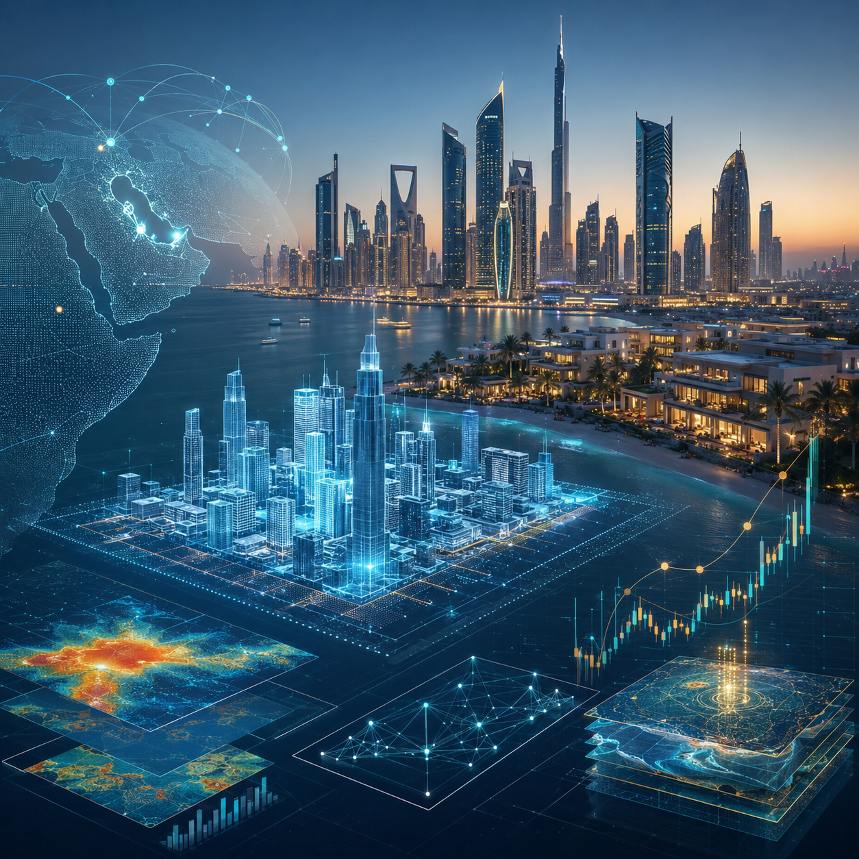
Digital transformation of infrastructure through geographical intelligence and engineering innovation
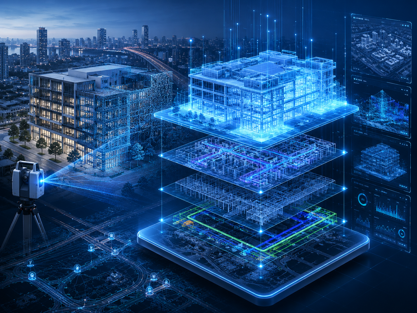
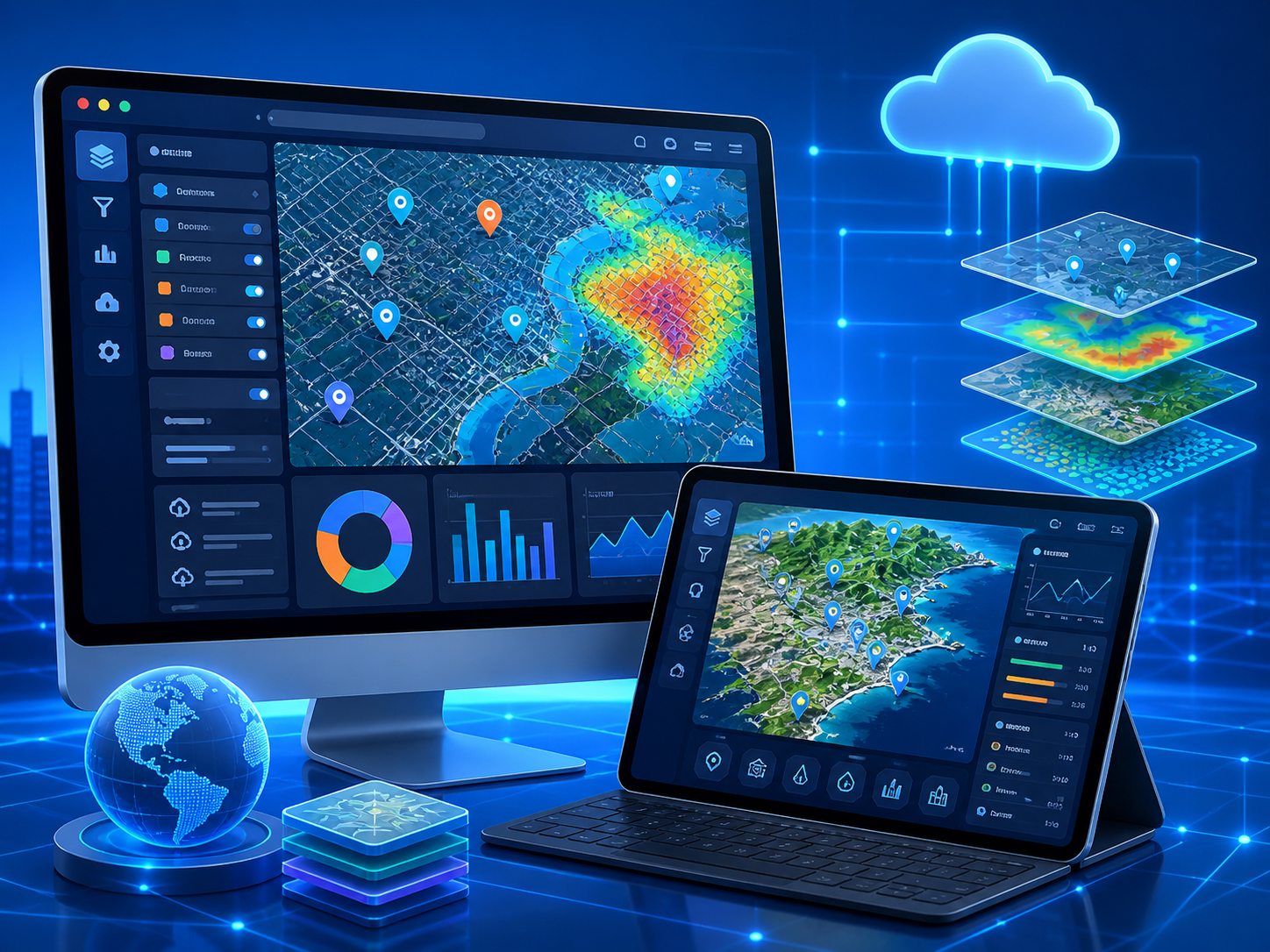
Transfer spatial data to integrated practical solutions, from design to project life cycle management via GIS and BIM and digital twins.
Learn moreAbout us
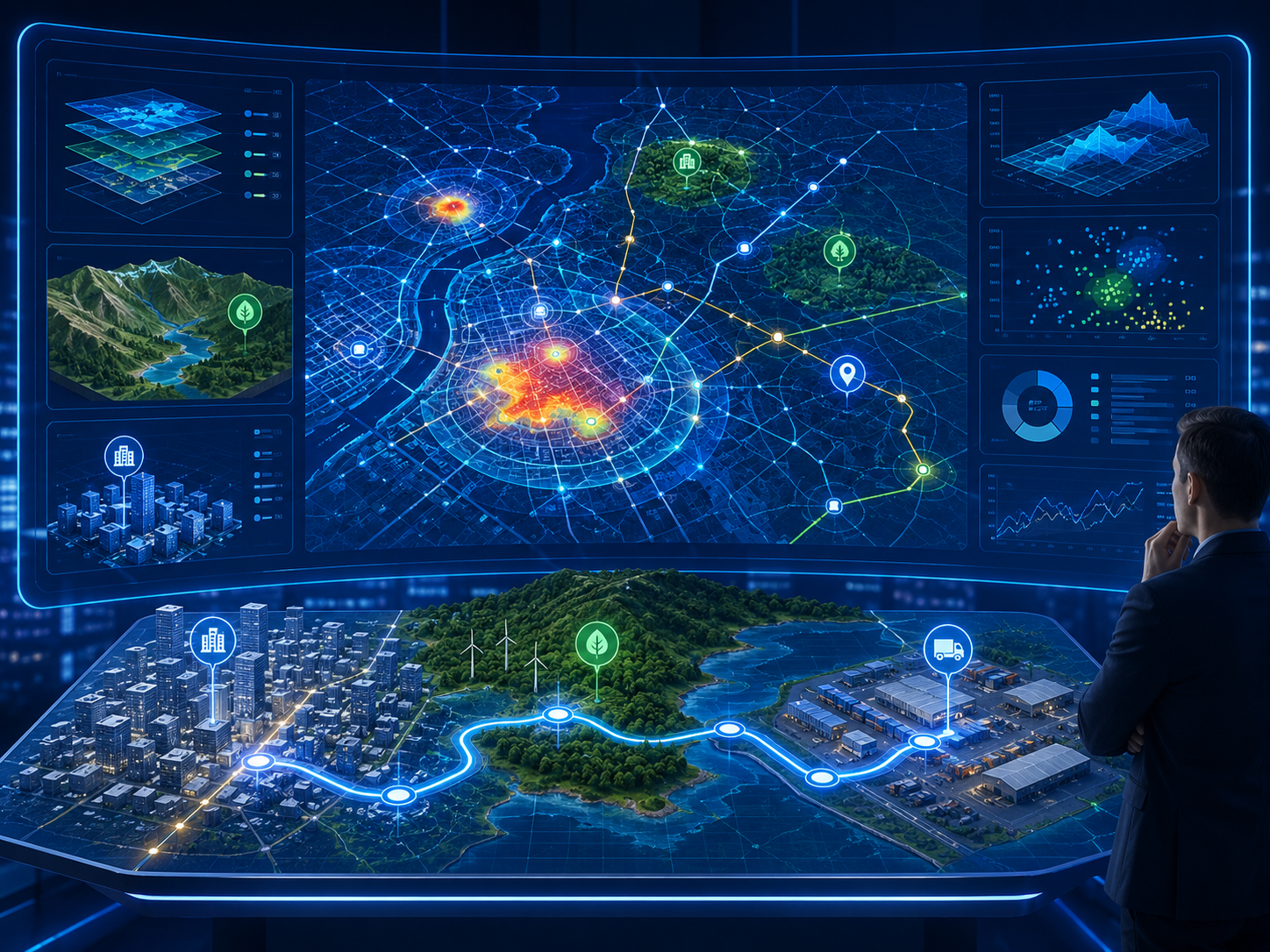
Your strategic partner for digital transformation and smart infrastructure
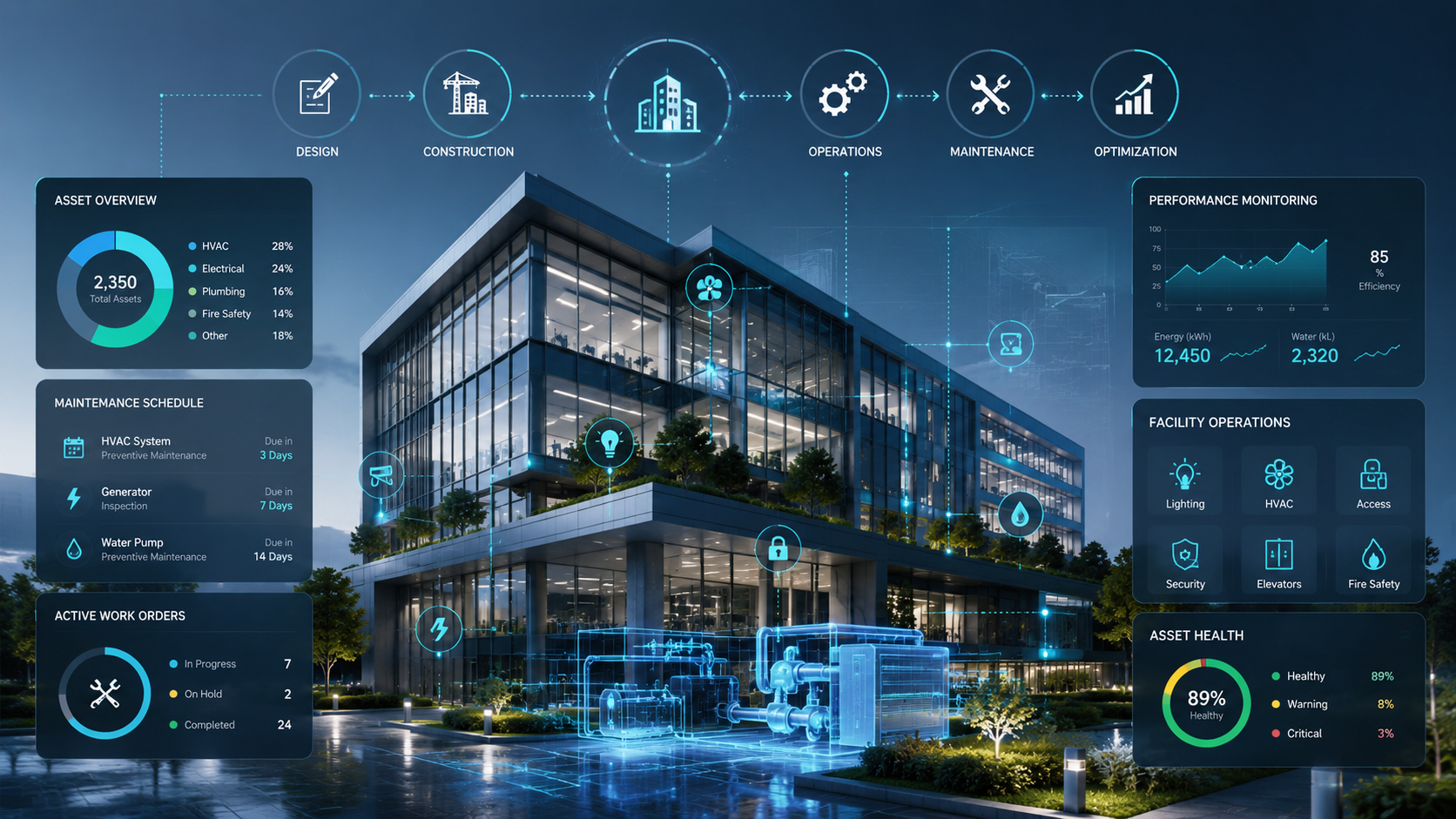
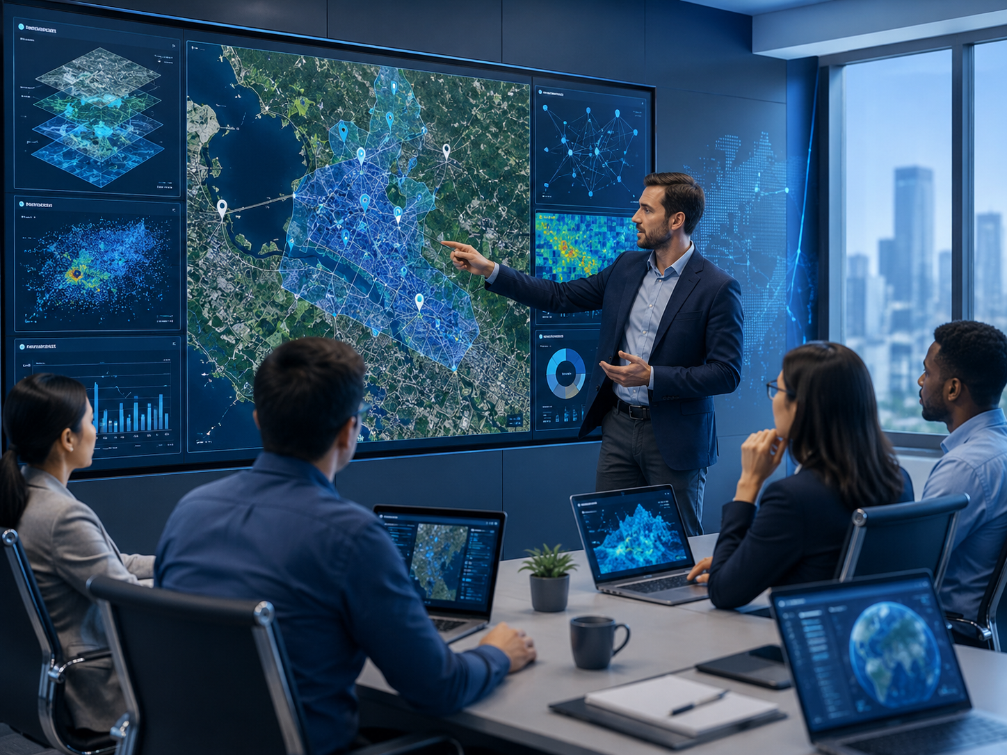
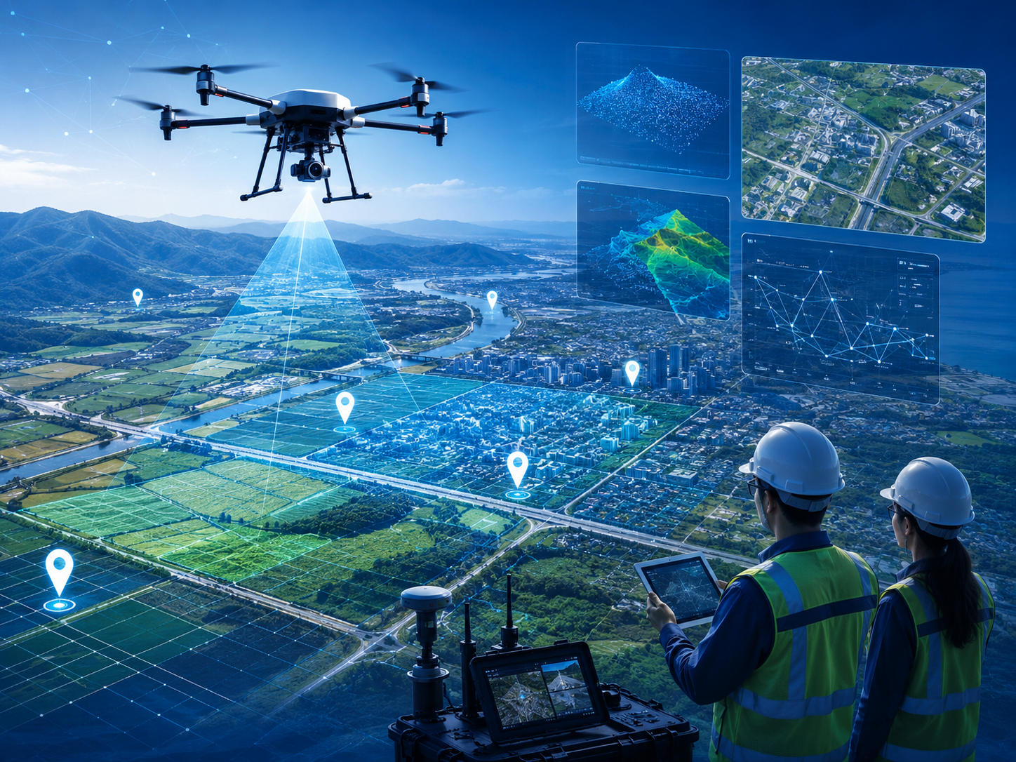
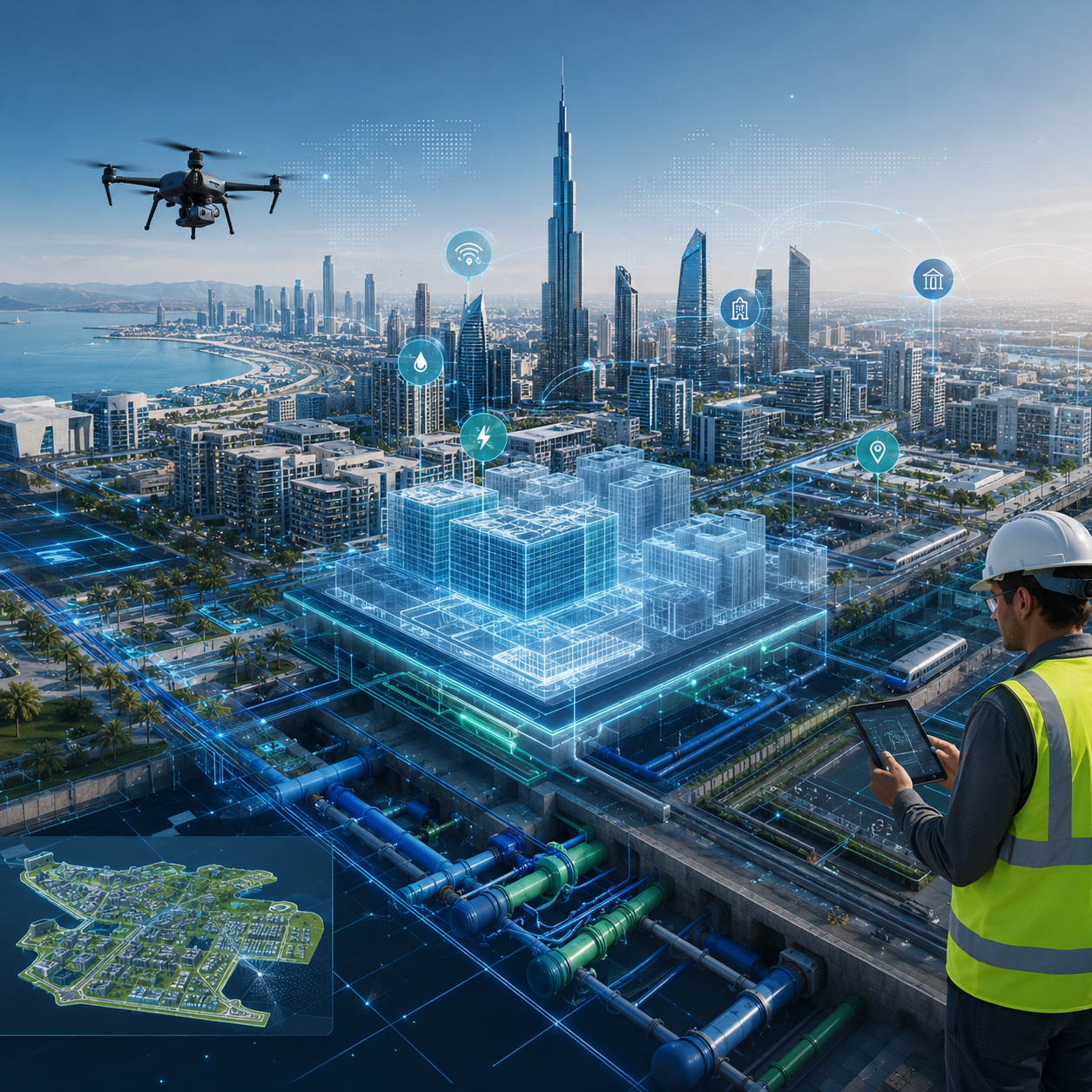
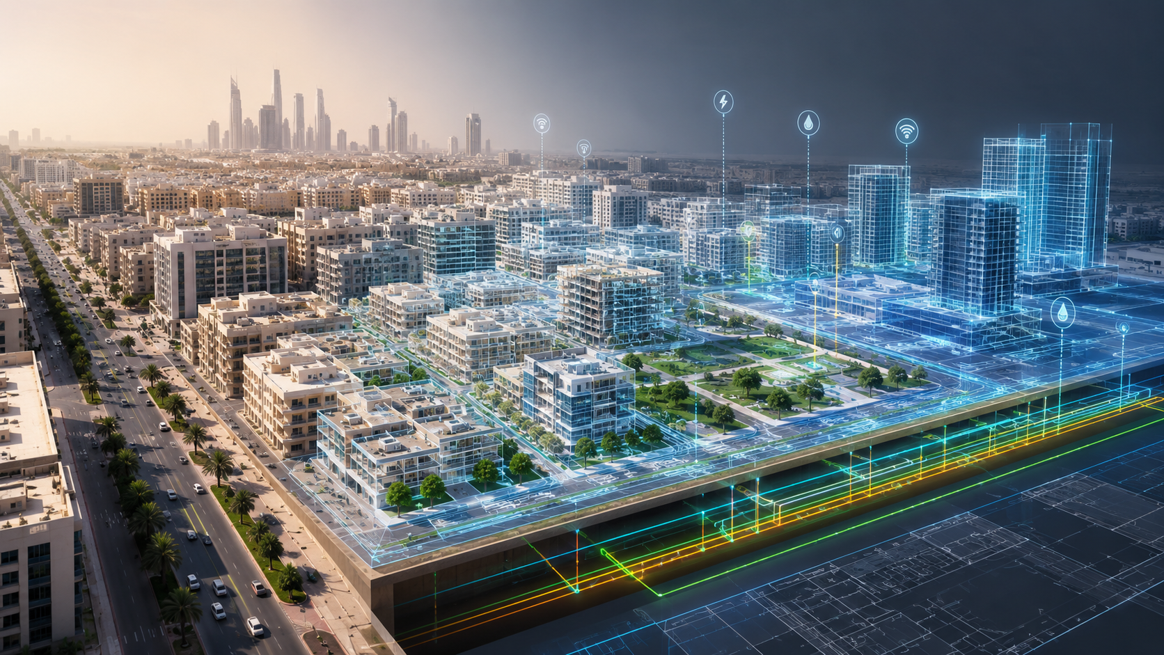
A leading Egyptian company in providing smart infrastructure solutions and digital transformation, where we are working to design and manage smart facilities and cities using the latest GIS and BIM technologies and digital twins, to help institutions and bodies to raise the efficiency . Field and spatial analysis, to the project life cycle management through interactive control panels and advanced digital solutions .

Our Mission
Empowering public and private organizations with advanced geospatial and 3D digital twin solutions to manage assets, optimize operations, and support precise, data-driven planning through specialized consulting and smart software platforms.

Our Vision
To be the leading strategic partner in digital transformation and smart infrastructure in Egypt and the region.

Our Goals
We believe understanding “where” is as important as knowing “what” and “why.” We deliver innovative geospatial and digital twin solutions that transform complex data into actionable insights and interactive models for smarter business decisions.

Our services
Integrated engineering and digital solutions
Our projects
A clear imprint in infrastructure and smart cities
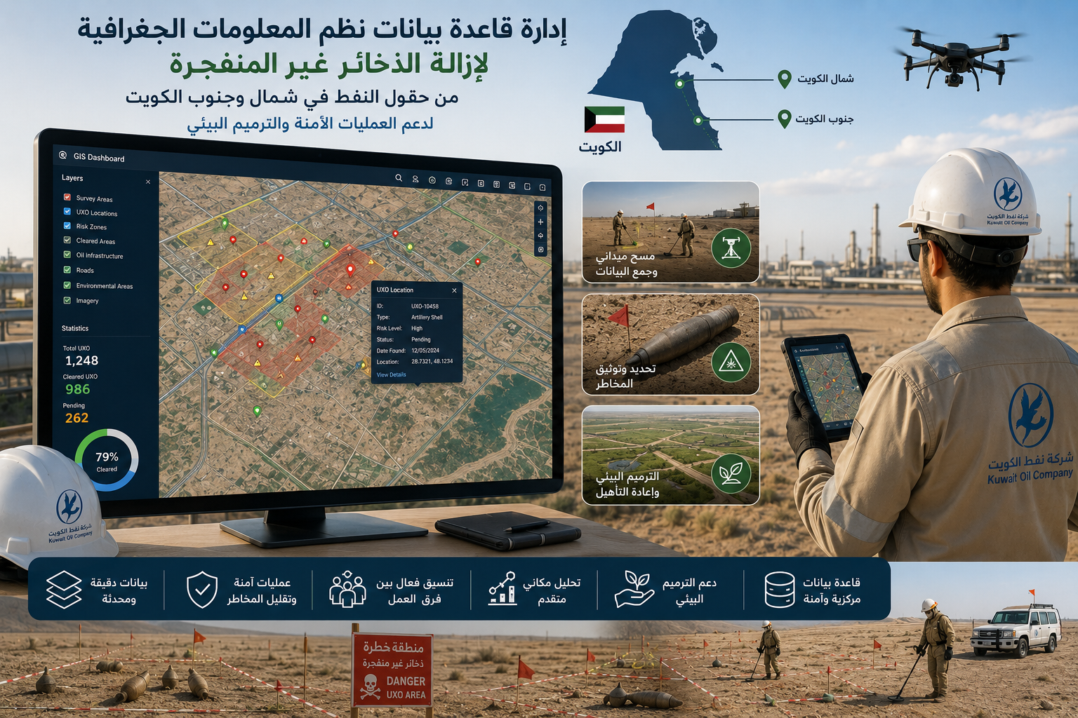
UNDP Kuwait - Unexploded Ordnance Removal
Managing GIS databases for unexploded ordnance removal projects. Supporting spatial analysis and survey operations across oil fields in northern and southern Kuwait. Accurately documenting hazardous zones and unexploded ordnance locations. Providing updated geospatial data to support safe field operations. Helping reduce risks for operational teams and o...
-

Location: Kuwait
-

Site space: 2000 meters
-

Duration: 1 year
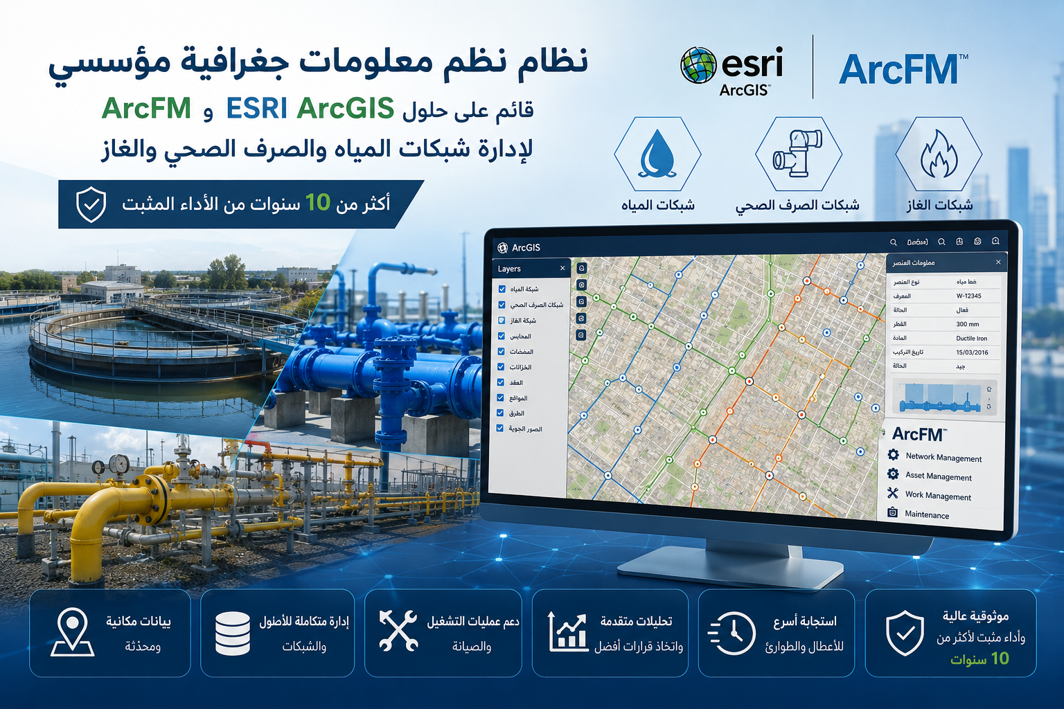
U-FM - Utility & Facility Management System
Developing an enterprise GIS system for managing critical utility networks. Utilizing ESRI ArcGIS and ArcFM solutions for network management and analysis. Managing water, wastewater, and gas networks through a unified platform. Enhancing infrastructure and asset tracking with high accuracy. Supporting operation and maintenance teams with integrated spati...
-
Location: U-FM
-
Site space: 2000 meters
-
Duration: 1 year
CEO Managers
Integrated experiences make the difference

Khaled al husseiny
CEOYour strategic partner for digital transformation and smart infrastructure
Karim Emad
General ManagerYour strategic partner for digital transformation and smart infrastructure
Careers
Discover career opportunities

GIS Proposal Writer (GeoAI & Digital Twins)
Description:
We are seeking a highly skilled and strategic GIS Proposal Writer to join our team. In this role, you will be responsible for crafting compelling, high-quality, and technically accurate proposals, grant applications, and tender responses. You will translate complex geospatial concepts into winning business propositions for clients across the MENA region and beyond. The ideal candidate will possess a strong foundation in traditional GIS methodologies alongside a solid understanding of cutting-edge trends like GeoAI, Digital Twins, and Smart Infrastructure. This position offers unique flexibility, available as either a Full-Time role or a Part-Time (as-needed) consultancy basis.
Requirements:
- Proposal Development: Lead the end-to-end writing, editing, and formatting of technical proposals, RFPs, RFIs, and tender submissions.
- Technical Translation: Collaborate with geospatial engineers and solution architects to translate complex technical workflows (such as spatial analytics, database management, and remote sensing) into clear, persuasive, and value-driven narratives.
- Strategic Copywriting: Seamlessly integrate modern geospatial paradigms—specifically GeoAI (Geospatial Artificial Intelligence) and Digital Twin technologies—into proposals to showcase forward-thinking capabilities.
- Compliance & Quality Assurance: Ensure all bids strictly meet client compliance matrices, technical requirements, and internal quality standards before submission.
- Content Repository Management: Maintain and update a reusable repository of boilerplate content, past performance citations, resumes, and technical case studies.
- Experience: 4 to 6 years of proven experience writing technical proposals, specifically within the GIS, remote sensing, IT, or engineering consulting industries.
- Core GIS Knowledge: A deep conceptual and practical understanding of Geographic Information Systems (GIS), spatial data analysis, and cartographic design.
- Esri Ecosystem: Solid familiarity with Esri-based technology, including ArcGIS Enterprise, ArcGIS Pro, and ArcSDE. o Open-Source GIS: Hands-on awareness or experience with open-source GIS platforms (e.g., QGIS, PostGIS, GeoServer).
- Domain Expertise: Demonstrated ability to write intelligently about advanced spatial solutions, including Digital Twin architecture, GeoAI models, and Smart Infrastructure solutions.
- Communication Skills: Exceptional command of written and spoken English, with the ability to articulate technical jargon into clear, compelling business value. (Arabic proficiency is a strong asset).
- Education: Bachelor’s degree in GIS, Geomatics, Geography, Computer Science, Information Technology, or a related field.

Senior 3D Modeler (Real-Time Engines & BIM)
Description:
We are seeking a highly experienced and versatile Senior 3D Modeler to bridge the gap between traditional architectural/spatial data and immersive, real-time visualization. In this role, you will transform complex structural, infrastructural, and spatial data into high-fidelity, interactive 3D assets and environments. The ideal candidate brings a rare mix of precision and creativity—capable of navigating both rigorous engineering models and cutting-edge interactive design. This position offers flexible engagement models, available as either a Full-Time role or a Part-Time (as-needed) contract based on pipeline demands
Requirements:
- Real-Time Environment Creation: Optimize, texture, and integrate complex 3D assets and large-scale environments into real-time gaming engines for interactive simulations, virtual walkthroughs, and live-data platforms.
- BIM & CAD Data Translation: Ingest, clean, and convert highly detailed architectural plans and engineering models into lightweight, performance-optimized 3D meshes without sacrificing critical spatial accuracy.
- Asset Optimization: Implement advanced optimization techniques (including LOD management, efficient UV unwrapping, and baking lighting/textures) to ensure smooth performance in real-time environments.
- Cross-Functional Collaboration: Partner closely with GIS experts, IoT developers, and software engineers to align 3D assets with real-world spatial coordinate systems and interactive operational data.
- Quality Assurance: Ensure all 3D outputs meet strict aesthetic standards, technical performance budgets, and project-specific accuracy requirements.
- Experience: Minimum of 7+ years of professional experience in 3D modeling, environment art, or technical visualization within industries such as gaming, architecture, simulation, or immersive technology.
- Game Engine Mastery (Must-Have): Expert-level proficiency in Unreal Engine (including Blueprints, Nanite, and Lumen) and/or Unity, with a proven track record of deploying interactive real-time applications.
- Mastery of Revit (BIM workflows, family creation, and data extraction). o Strong proficiency in AutoCAD for interpreting 2D/3D engineering documentation. o Working knowledge of 3ds Max or Maya for asset pipeline bridging is highly desirable.
- Technical Art Skills: Deep understanding of PBR (Physically Based Rendering) texturing workflows, material creation, UV layout optimization, and vertex budget management.
- Education: Bachelor’s degree in Architecture, 3D Animation, Game Design, Civil Engineering, or a related field (equivalent portfolio experience will be heavily considered).
Latest News
Keep update with our blog posts
Our Partners
Keep update with Our Partners


Start Now
Let’s Build Your Vision Together
Whether you’re looking for innovative engineering solutions, digital transformation, or GIS expertise, our team is ready to support your goals. Reach out today and let’s build something remarkable.
Get in Touch