 القاهرة - شيراتون المطار - النزهة - رقم بريدى 4471347

 info@geopatra.org

U-FM - Utility & Facility Management System
-

Location: U-FM
-

Site space: 2000 meters
-

Duration: 1 year
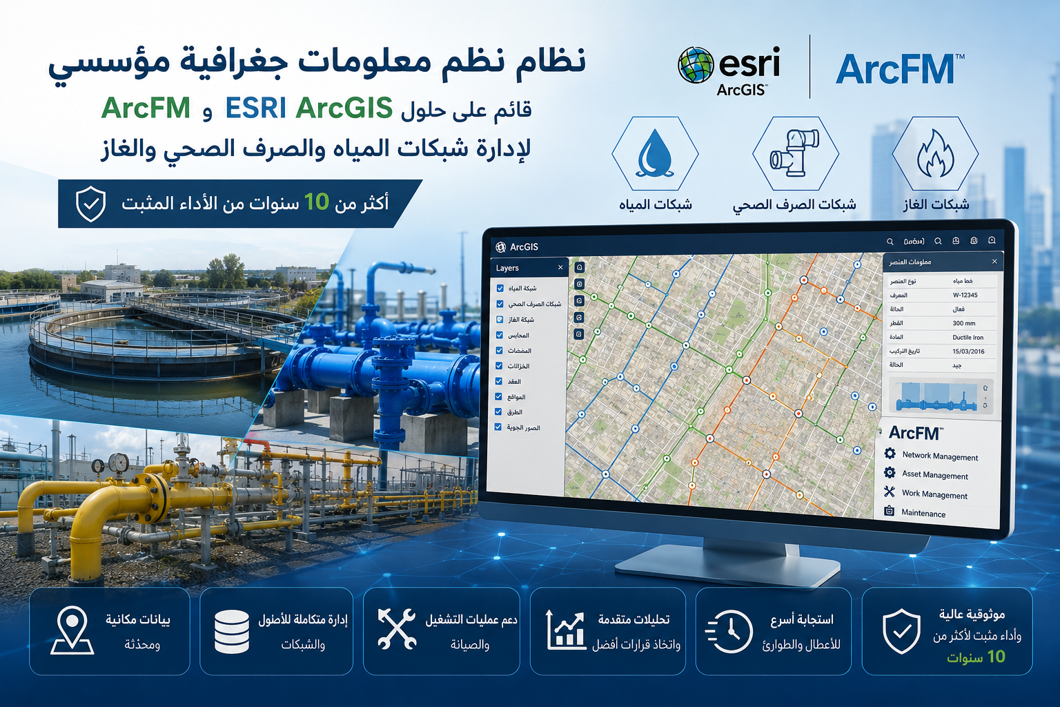
Developing an enterprise GIS system for managing critical utility networks.
Utilizing ESRI ArcGIS and ArcFM solutions for network management and analysis.
Managing water, wastewater, and gas networks through a unified platform.
Enhancing infrastructure and asset tracking with high accuracy.
Supporting operation and maintenance teams with integrated spatial data.
Providing advanced analytical tools for more efficient operational decisions.
Improving response time for faults and maintenance activities.
A reliable system with over 10 years of proven performance.