 القاهرة - شيراتون المطار - النزهة - رقم بريدى 4471347

 info@geopatra.org

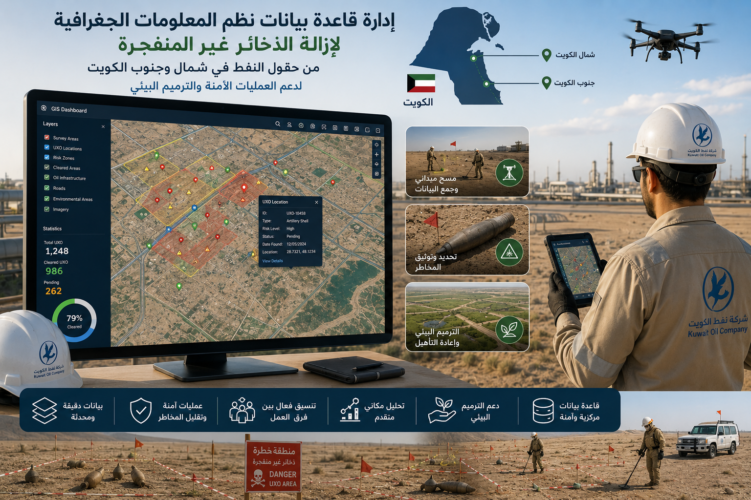
UNDP Kuwait - Unexploded Ordnance Removal
-

Location: Kuwait
-

Site space: 2000 meters
-

Duration: 1 year
Managing GIS databases for unexploded ordnance removal projects.
Supporting spatial analysis and survey operations across oil fields in northern and southern Kuwait.
Accurately documenting hazardous zones and unexploded ordnance locations.
Providing updated geospatial data to support safe field operations.
Helping reduce risks for operational teams and oil infrastructure.
Supporting environmental restoration and land rehabilitation efforts.
Enhancing coordination between safety, engineering, and operations teams.
Utilizing GIS technologies for advanced analysis and more effective decision-making.