 القاهرة - شيراتون المطار - النزهة - رقم بريدى 4471347

 info@geopatra.org

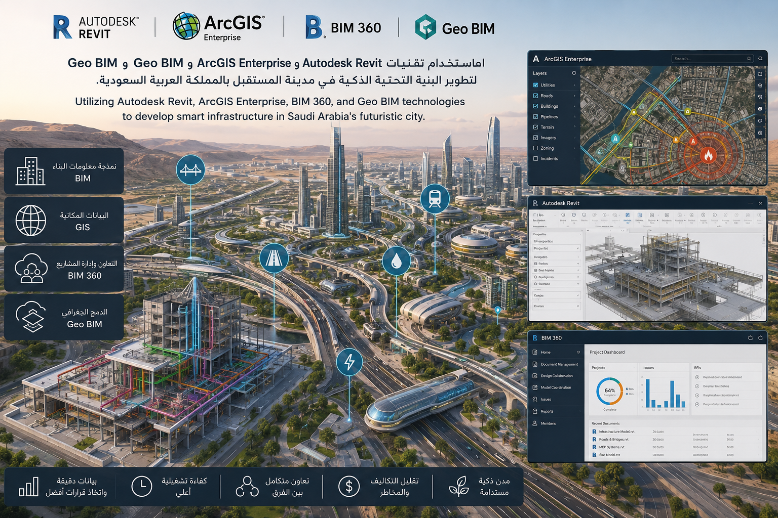
NEOM Project - Nebian Main Water Transmission Line
-

Location: Future City in Saudi Arabia
-

Site space: 2000 meters
-

Duration: 1 year
Utilizing Autodesk Revit for accurate building and infrastructure modeling.
Using ArcGIS Enterprise to manage and analyze geographic and spatial data.
Applying BIM 360 to enhance collaboration between design, construction, and management teams.
Integrating Geo BIM to connect building models with real-world geographic data.
Developing smart infrastructure that supports modern urban planning.
Improving project management efficiency and reducing errors during execution.
Supporting better decision-making through accurate and integrated data.
Contributing to the development of a futuristic smart city in Saudi Arabia.